 By Eliza Popova
The focus gathered information about the details of the dam, about the direction in which the water went, and about the level of flooding in some settlements. The first report on the actions of the Russian Federation on Kurakhov and the possible undermining in the afternoon on November 11 wrote a volunteer of the 24th OSHB "Aidar" Stanislav Bunyatov with the call sign "Osman". The Kurakhiv Dam, according to him, is destroyed by the Russians.
According to the fighter, water can move in the western direction and flood the villages on the way to the settlement rich. On the map you can see what is said, about the villages on the Vovchiy River: old thorns, watches, Konstantinopil. The volunteer emphasized that the Russians are destroying in this area "everything is living". The roads, according to him, are still traveling, but there is a problem for moving armored vehicles with soil roads.
The breakthrough of the Ternovsky Dam was confirmed by the head of Donetsk Ova Vadim Filashkin, it is reported in the post of official, published at 16:32 in the Telegram channel. According to him, there are no floods yet. On the other hand, water levels of 1. 2 meters have risen in the area of the Great Novosilka. "This blow is potentially threatening to residents of settlements on the Vovchiy River - both in Donetsk region and in the Dnieper region," the official said.
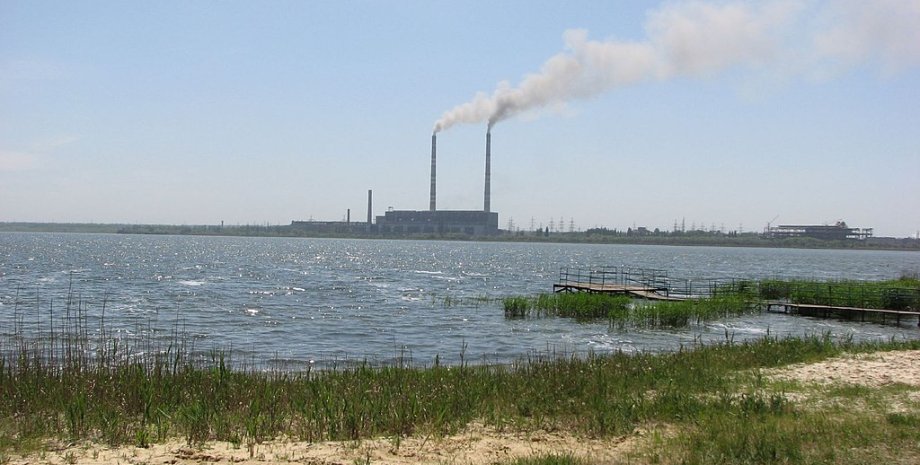
The blasting of dams near Kurakhov, in the area of the village of Stari Terny, was also confirmed by the head of Kurakhiv city military administration Roman Padun in a comment to the publication "Public Donbas". According to him, the water went down, to villages located below. The official had no information about the power and nature of the destruction. The Kurakhiv Reservoir is a reservoir located on the Vovchiy River, which flows into the Samara River, the left tributary of the Dnieper.
The full volume is 62. 5 million cubic meters. m (or 0. 0625 cm. The main purpose of the hydro -object is to cool the Kurakhiv TPP. On the hydrographic map of the Samara River and its tributaries, it can be seen that the Vovcha River flows through the Donetsk region, then causes the Dnipropetrovsk region and flows into Samara east from the city of Samara (the old name - Novomoskovsk). The Ukrainian command did not confirm the blasting of Kurakhiv TPP dams.
Instead, some details have added the analysts of the Deepstate project. They explained that the enemy tries to break into Kurakhovo and press on the positions of the Armed Forces of three sides. The map of analysts indicates that from the north the city is protected by the Kurakhiv reservoir, and the enemy presses towards the settlement of Illinka (through it the way through the bridge inside the Kurakhov). From the east - frontal attacks from Maximilyanivka.
Several "tongues of attacks" - from the south: from far and work. The inscriptions of analysts indicate that the Armed Forces of the Russian Federation try to get around the Kurakhove from the flanks and cut the road leading from Donetsk towards Zaporozhye. The approximate distance to this road is about 10 km, they explained. It should be noted that on November 11, an article of The Wall Street Journal, dedicated to Kurakhiv TPP, appeared.






All rights reserved IN-Ukraine.info - 2022