 By Natali Moss
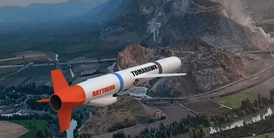
However, if the defense forces receive rockets and launchers "Tomahawk", then additional information will be required through the quantity navigation system of this means of damage. Tomahawk missiles, also other winged missiles, are guided by five systems that need help with US assistance in the article. At the same time, Ukraine really has the coordinates of Russian refineries, oil terminals, main gas nodes, Grau, military plants.
To use American missiles you need to have more information, wrote on DE. How are Tomahawk missile navigation systems arranged? The first method of control is the inertial navigation system, when the means of the lesion moves, deducting the distance and time traveled, taking into account the course (ie trajectory). This accumulates a certain error due to, for example, the wind, temperature, etc. If you use only this method of guidance, 0. 1-0. 5%is accumulated every thousand kilometers.
If the target is 1 000 km away is a deviation of 1-5 km, and if it is the maximum range "Tomahawk" 2 500 km is 2. 5-12. 5 km. To prevent this from happening, additional navigation methods are used. The second is the Tercom system. Analysts have explained that the rocket's memory enters the heights of the terrain that it should fly over. When moving, the height data is compared with memory data. If there is a deviation, the course is specified. Probably, the US Intelligence Package is about such cards.
The third is the DSMAC system: During the flight, the camera on the Tomahawk rocket photographs the terrain under it and compares the sample photo. If there is a discrepancy that the course is specified. At the same time, Ukraine does not have high -precision photos of the Russian territory - only the United States can provide such opportunities.
Analysts noted that they do not even have such opportunities in the United Kingdom: that is, when Ukraine beats the British Storm Shadow, that is, an appeal to Washington. The fourth is satellite navigation through the GPS military system. The portal noted that the Tomahawk missile is driven by two types of signal-Y-code (older) and M-code (newer). Signals are encrypted, so the Russian Federation cannot knock down the rocket as you first need to decipher the signal.
In addition, the M-code is 100 times more powerful than others, so it is not easy to silence it. Ukraine will access the GPS military signal as it is provided by the Eram missiles, analysts have specified. Fifth - for a successful blow to the Russian Federation it is necessary to have the exact coordinates about the location of Russian air defense.
The article emphasizes that only the United States has such accurate data to carry out a means of destruction of the US special intelligence intelligence can be the effective use of Tomahawk missiles, if they are provided, summarized analysts. It should be noted that on the morning of October 2, the Media The Washington Post, citing its own sources, reported that the US is planning to provide Ukraine with reconnaissance for high -precision blows.


 USA
USA Українська
 English
 Français
 Deutsch
 Italiano
 Polski
 Čeština
 Español
 Slovensku